Kandalama City
Kandalama: Scenic village in Sri Lanka near Dambulla, known for its picturesque landscapes, ancient cave temples, and the iconic Kandalama Hotel.
Kandalama Reservoir
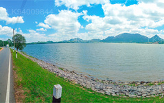
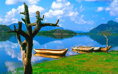
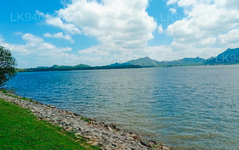
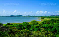
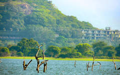
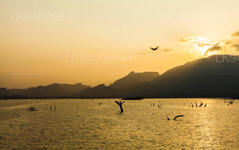
Amongst the craggy regions of the Central province of Sri Lanka is a placid and beautiful man-made lake, which is actually the Kandalama Reservoir. Created by kings of long gone times in order to provide water for farming irrigation; the the Kandelle or Candelay reservoir, as it was also known, is located in the town of Kandalama and was made by damming one of the main tributaries of Kala Wewa.
The reservoir measures 4.8 km (3.0 miles) long and 2.3 km (1.4 miles) across at its largest parts; with a catchment area of 102 km2 (39.4 square miles) and a volume of 33,300,000 m3 (1.18×10⁹ cubic ft). The ancient wall of the dam itself has a massive height of 21 m (69 ft) and width of 1,600 m (5,200 ft), making visitors wonder if it was built by giants. The reservoir has water all throughout the year and provides irrigation extending up to the distant Kekirawa region.
Pertaining to the history of the reservoir, not much is known; though it is ancient and lies less than 8 km from the famous Rock Temple of Dambulla. It has also been a famous site of tourism even during the era of the British invasion of Ceylon in the 1800s. Many a olden day foreign adventurer mentioned it during their travels. Here are some of their comments:
“Kandelle is a scattered village, similar to the preceding . It contains about sixteen families, who subsist, on the produce of one large paddy-field. The lake or tank of Kandelle, which is close by, is a great work, and the best example of the kind of work, that I have ever seen. The lake is about three or four miles in circumference, and, like that of Minere, skirted with green plains. The embankment by which the water is confined is a mile and one-third long. It extends nearly in a straight line, from a rocky hillock at one extremity, to a high ledge of rock at the other. Its perpendicular height may be twenty feet; at its base, it may be hundred and fifty or two hundred feet wide. Its face towards the lake is naked, sloped at an angle of about 45 degrees, and composed of stones that rise one above the other like steps. The stones are of the same size nearly; from two to three feet long, about two high, and from one to two wide.
The lake has two outlets: the principal one about a hundred yards from the rocky ledge, through which a river is constantly flowing; and another near the opposite extremity of the embankment, which is commonly dry, and carries off water only when the lake is unusually high.”
John Davy, M. D., F.R.S, F. R. S.E. : An Account of the Interior of Ceylon, and of Its Inhabitants: with Travels in that Island, Year 1821
“The Lake of Kandelle, or as it is commonly termed, the Kandelle waters, is, in the opinion of connoisseurs, the most beautiful lake in Ceylon, and, from its being enveloped on all sides by lofty hills, it will bear inspection from several points. This is more than that can be said of many of the lakes, which are generally tame at the lower extremities. But it is the peculiar beauty of the waters of Kandelle, that in their case the ground ascends everywhere from their edge with a nearly equal degree of boldness.”
Charles Pridham, Esq., B.A., F.R.G.S.: A Historical, Political and Statistical Account of Ceylon and its Dependencies, Year 1849
“Before quitting the subject of Trincomalee, the hot wells in its vicinity, and the celebrated lake of Candelay demand cursory notice; the one as an artificial work, interesting in its antiquary and the political economist and the other as a natural curiosity. The Candelay lake is situated within thirty miles of Trincomalee, in an extensive and broad valley, around which the ground imperceptibly ascends towards the distant hills that envelop it. In the centre of the valley, a long causeway principally made of masses of rock has been constructed to retain the waters that from every side pour into the space inclosed within the circumjacent hills and the artificial dam thus formed. During the rainy season, when the lake attains its greatest elevation, the area of ground over which the inundation extends may be computed at fifteen square miles. This work of art, and others of nearly equally gigantic proportions in the island, sufficiently indicate that at some very remote period of Ceylon was a densely peopled country, and under a government sufficiently enlightened to appreciate the execution of an undertaking which, to men ignorant of mechanical powers, must have been an Herculean operation; for such is the capricious nature of the mountain streams of this island, where heavy rains frequently fall for many successive days without intermission, that no common barrier would suffice to resist the great and sudden pressure that must be sustained on such occasions. Aware of this peculiarity in the character of their rivers, the Cinghalese built retaining walls that support the waters of the lake of Candelay with such solidity and massiveness as to defy the utmost fury of the mountain torrents. Nearly the whole of its extent is formed with vast hewn masses of rock, faced with stones eight or ten feet thick at the base, placed like steps, and laid in regular layers, to move which by sheer physical force must have required the united labor of thousands.”
Wm. H. Allan and Company: Rambles in Ceylon by an Officer, Asiatic Journal and Monthly Miscellany Volume 33, Year 1840.
Today Kandalama stands as a testament to ancient architectural knowledge and promotes irrigation and the local fishing industry. It still remains one of the most beautiful reservoirs of the country, admired by the many visitors.
【Text by Lakpura™. Images by Google, copyright(s) reserved by original authors.】
About Central Province
The Central Province of Sri Lanka consists primarily of mountainous terrain. The province has an area of 5,674 km², and a population of 2,421,148. Some major towns include Kandy, Gampola (24,730), Nuwara Eliya and Bandarawela. The population is a mixture of Sinhalese, Tamil and the Moors.
Both the hill capital Kandy and the city of Nuwara Eliya are located within the Central Province as well as Sri Pada. The province produces much of the famous Ceylon tea, planted by the British in the 1860s after a devastating disease killed all the coffee plantations in the province. Central Province attracts many tourists, with hill station towns such as Kandy, Gampola, Hatton and Nuwara Eliya. Temple tooth or Dalada maligawa is the main sacred place in Centrel province.
The climate is cool, and many areas about 1500 meters often have chilly nights. The western slopes are very wet, some places having almost 7000 mm of rain per year. The eastern slopes are parts of the mid-dry zone as it is receiving rain only from North-Eastern monsoon. The Temperatures range from 24°C at Kandy to just 16°C in Nuwara Eliya, which is located 1,889 m above sea level. The highest mountains in Sri Lanka are located in the Central Province. The terrain is mostly mountainous, with deep valleys cutting into it. The two main mountain regions are the central massif and the Knuckles range to the east of Kandy.

